
Blog
Big Bend National Park - Texas
Dates of stay: January 7 - 14, 2022
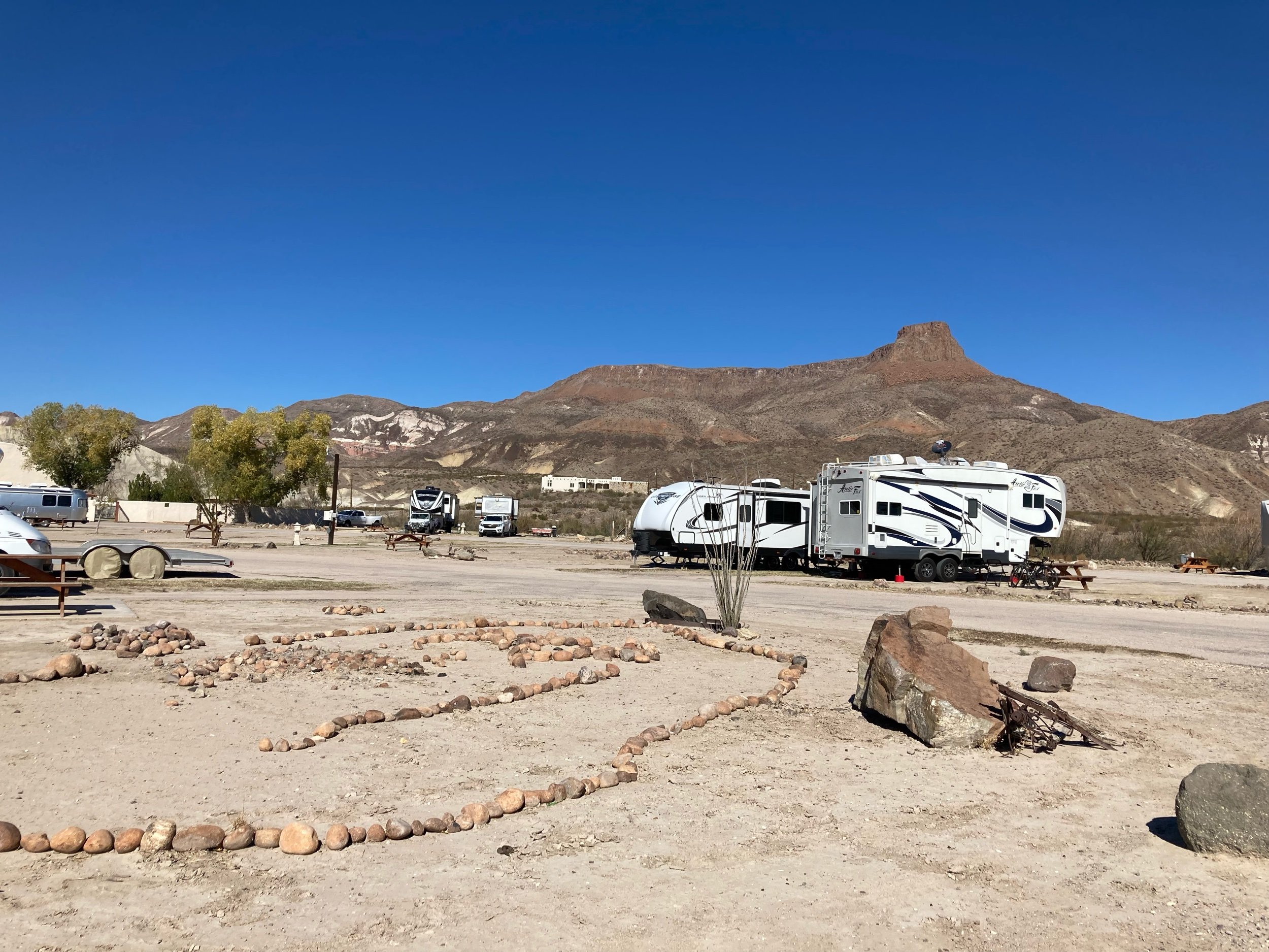
Campground: Maverick Ranch, Lajitas, TX
Made it to Big Bend National Park! Getting to our campsite included driving through the park from the north entrance, so it was fun to get a glimpse of this massive park on the way to our destination. While we technically have been at a few other National Parks and Recreation Areas (i.e. Everglades, Gettysburg, etc), this is will be the first time we’ve really explored a National Park in any great detail, and we’ll start that journey tomorrow. The big spaces get even bigger here, and it is very dry and arid. The days are warm and sunny and the nights are cool, and full of lots of coyotes howling at night. I already feel like a week won’t be enough…
Spent our first full day at BIBE (the alpha code), Big Bend National Park. The alpha code is the code that the park service/rangers use to identify all of the national parks and it is created by taking the first two letters in the name of the park depending on its name (I.e. Yosemite is one word, so YOSE, or Grand Canyon is two, so GRCA).
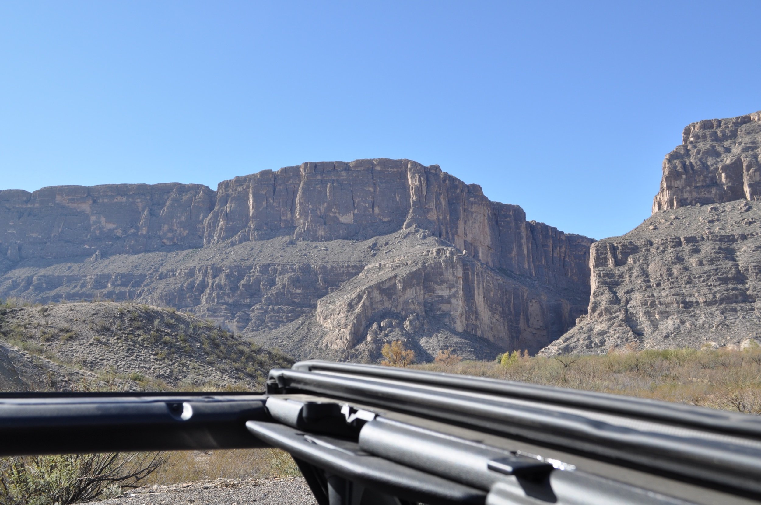
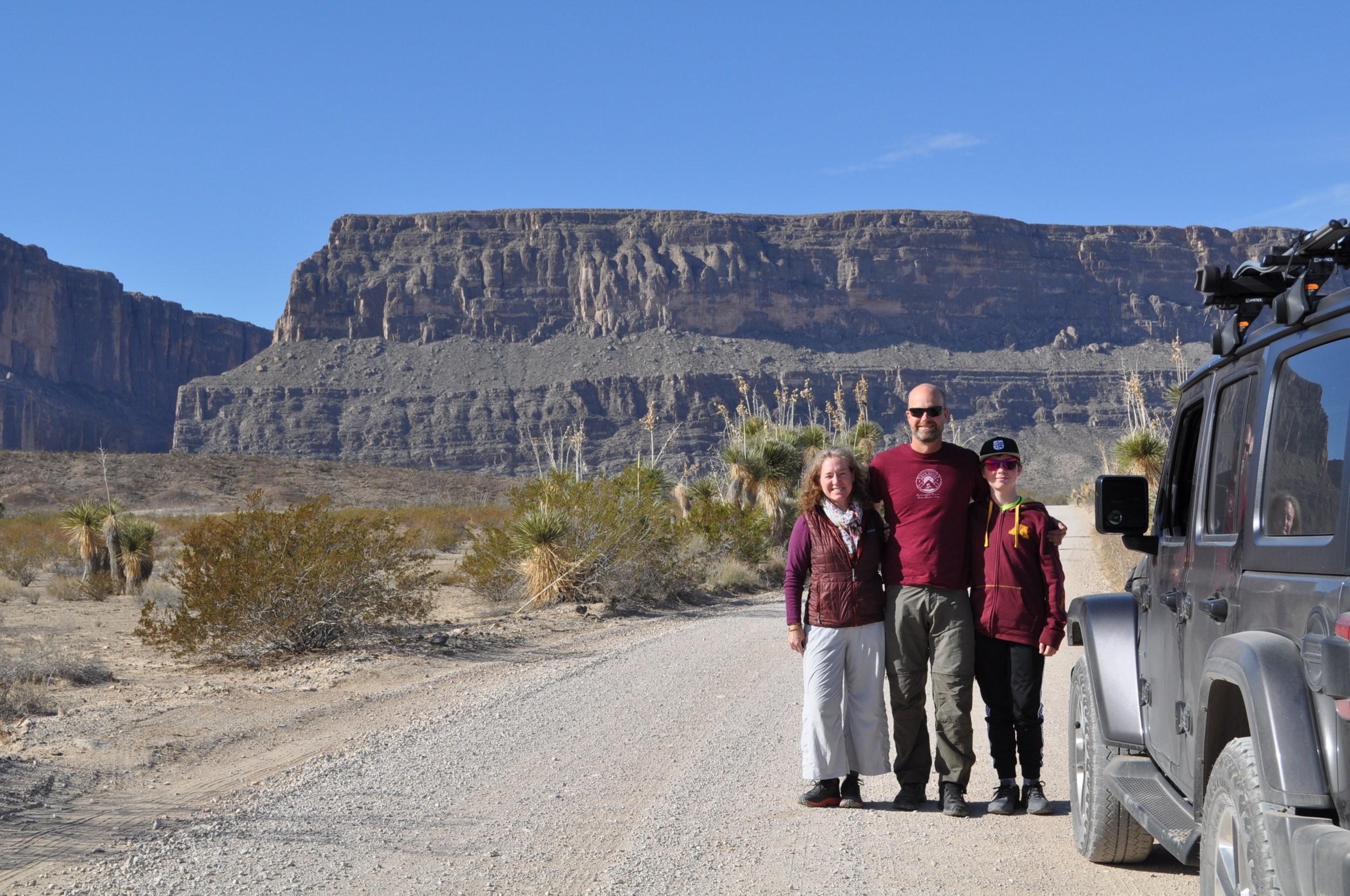
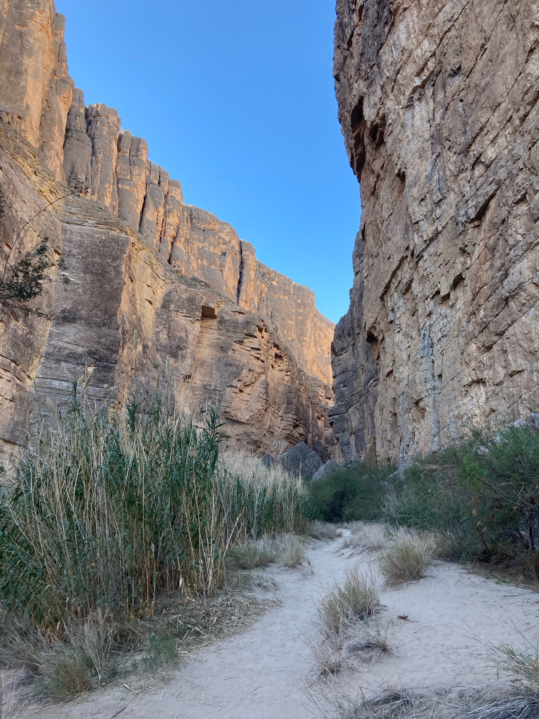
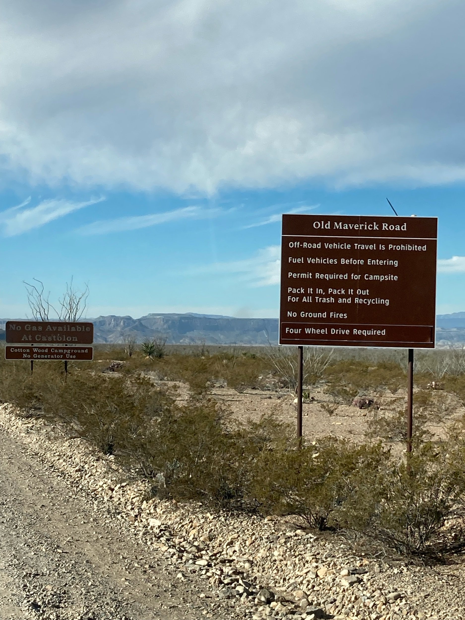
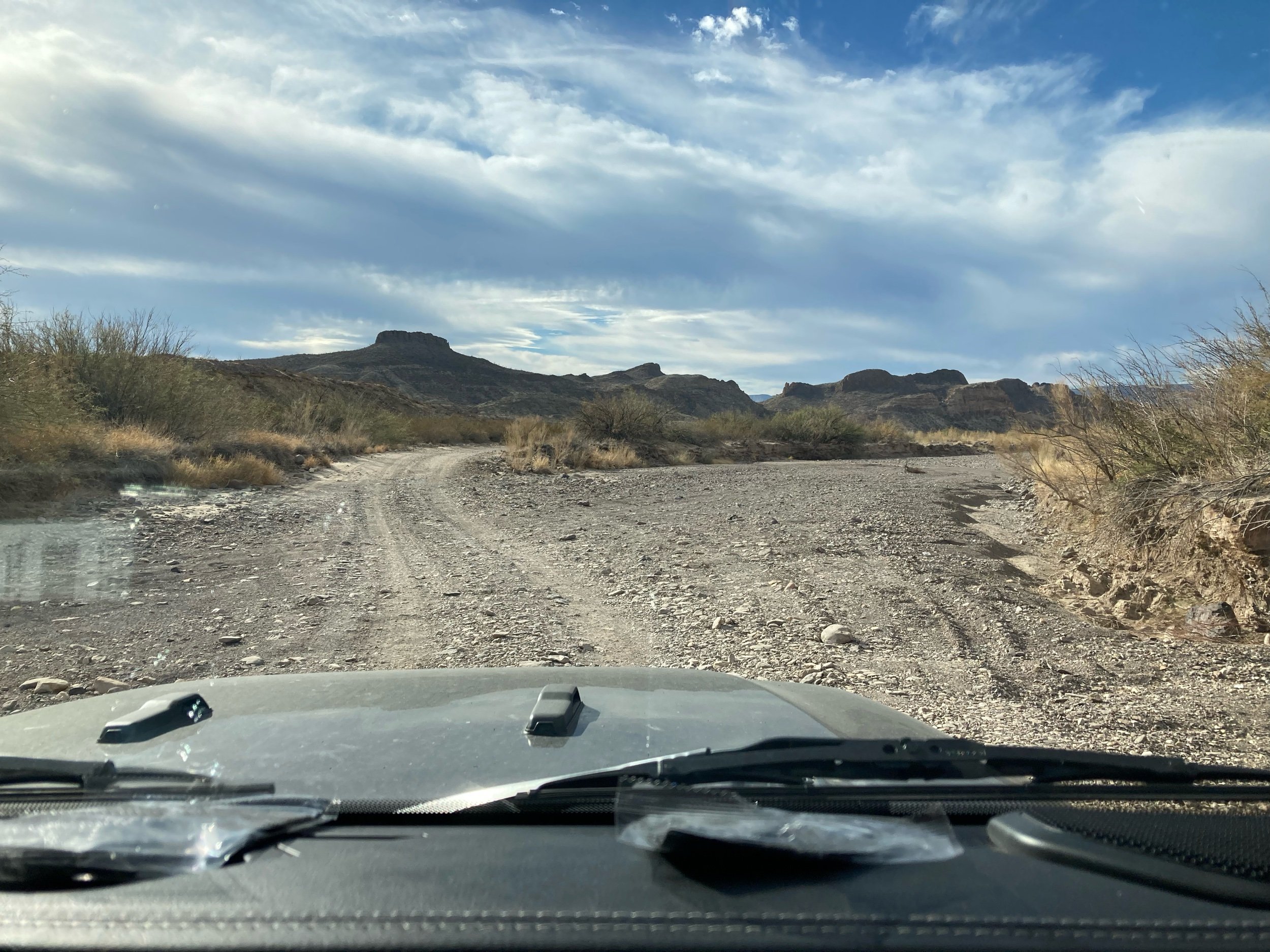
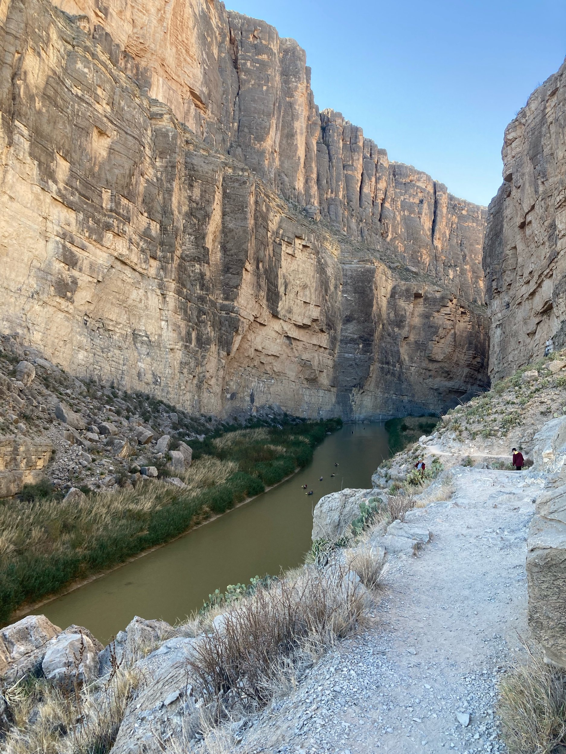
Once again, thankful that we have the Jeep in tow as it allowed us to make it to many areas of the park on this trip that we would have not been able to do if we didn’t have a high-clearance, 4WD. Our first off-road experience was on Old Maverick Road, heading into the park from the west side. Our destination was Santa Elena Canyon, where we were treated to unbelievable view of a canyon that had been carved out over the centures. This is also the area where the Rio Grande intersects the US and Mexico and we were within a few feet of the Mexican border. We actually waded across a stream to the Santa Elena canyon trail (on the US side) and hiked back into a massive canyon that made us feel like the size of a pinhead. We were able to see kayakers down below on the river, and knew we had to add that experience to our bucket list for a future trip.
We drove the scenic Ross Maxwell drive and discovered Castolon - an old “town” that used to be a post for the Army in the 1920’s and later a store, and a community of about 35 people. The historic barracks burned down in a 2019 fire. A total of 950 acres burned; the fire actually started across the Rio Grande but the smoldering ashes were carried by the wind and fell down on the roof of the barracks, creating the fire.
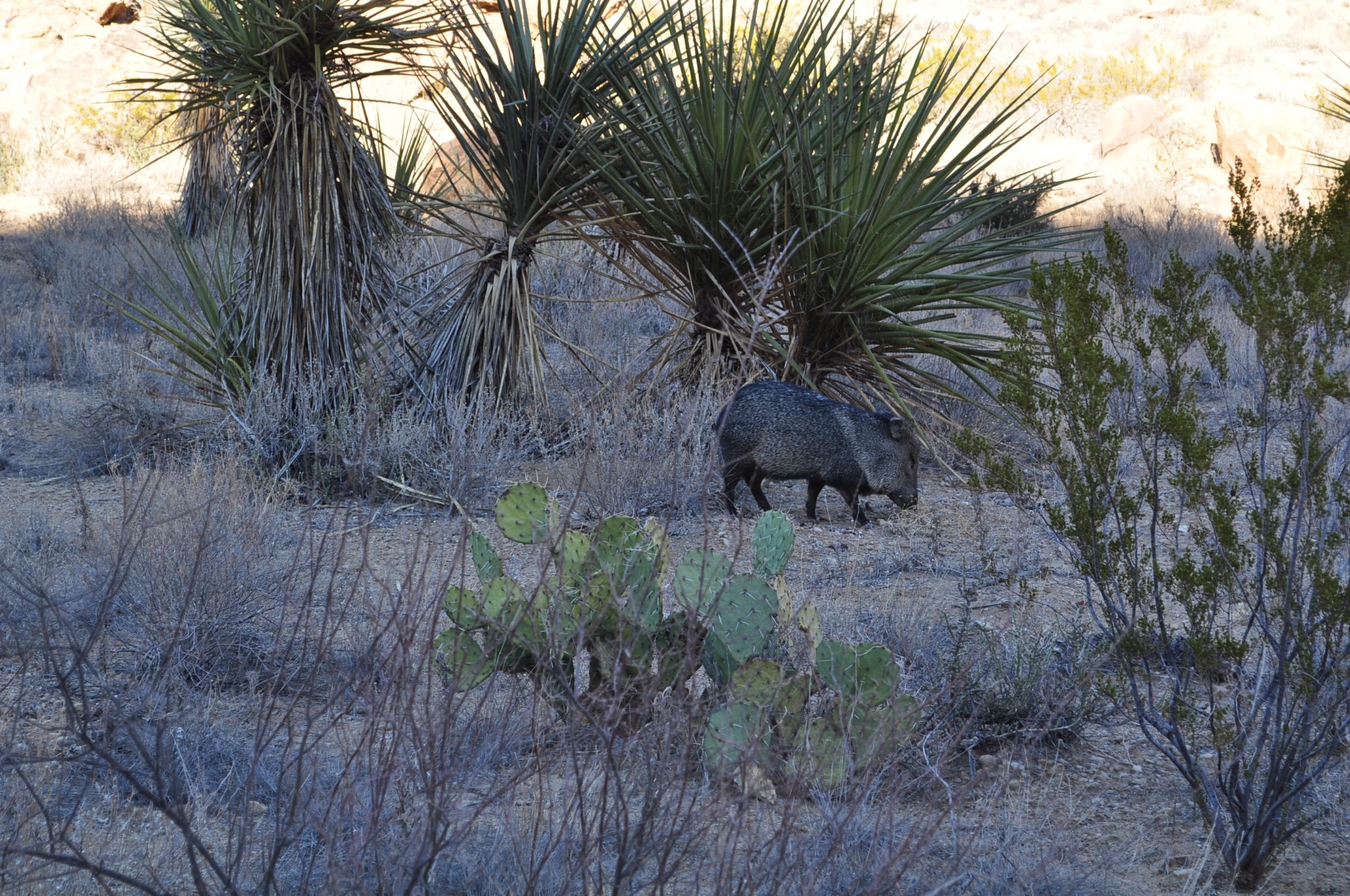
The wildlife was more abundant today, and we saw a few roadrunners! Stopped off for a photo op at Mule Ear Peaks, a popular spot within the park. We did another off-road trail on Grapevine Falls Road - this as a very bumpy and slow-going ride, and we do not recommend taking anything other than a 4WD car up this road! This road took us to the trail head of Balancing Rock trail, and easy but sandy trail that leads up to a .25 mile rock scramble to a very picturesque spot. We had some fun with the pictures in this area, as it looks like you are holding up a massive rock when positioned just right. We also saw a wild javelina right along the trail! This was neat, as they are more nocturnal and also travel in groups, but he was just out by himself, munching on a few bushes.

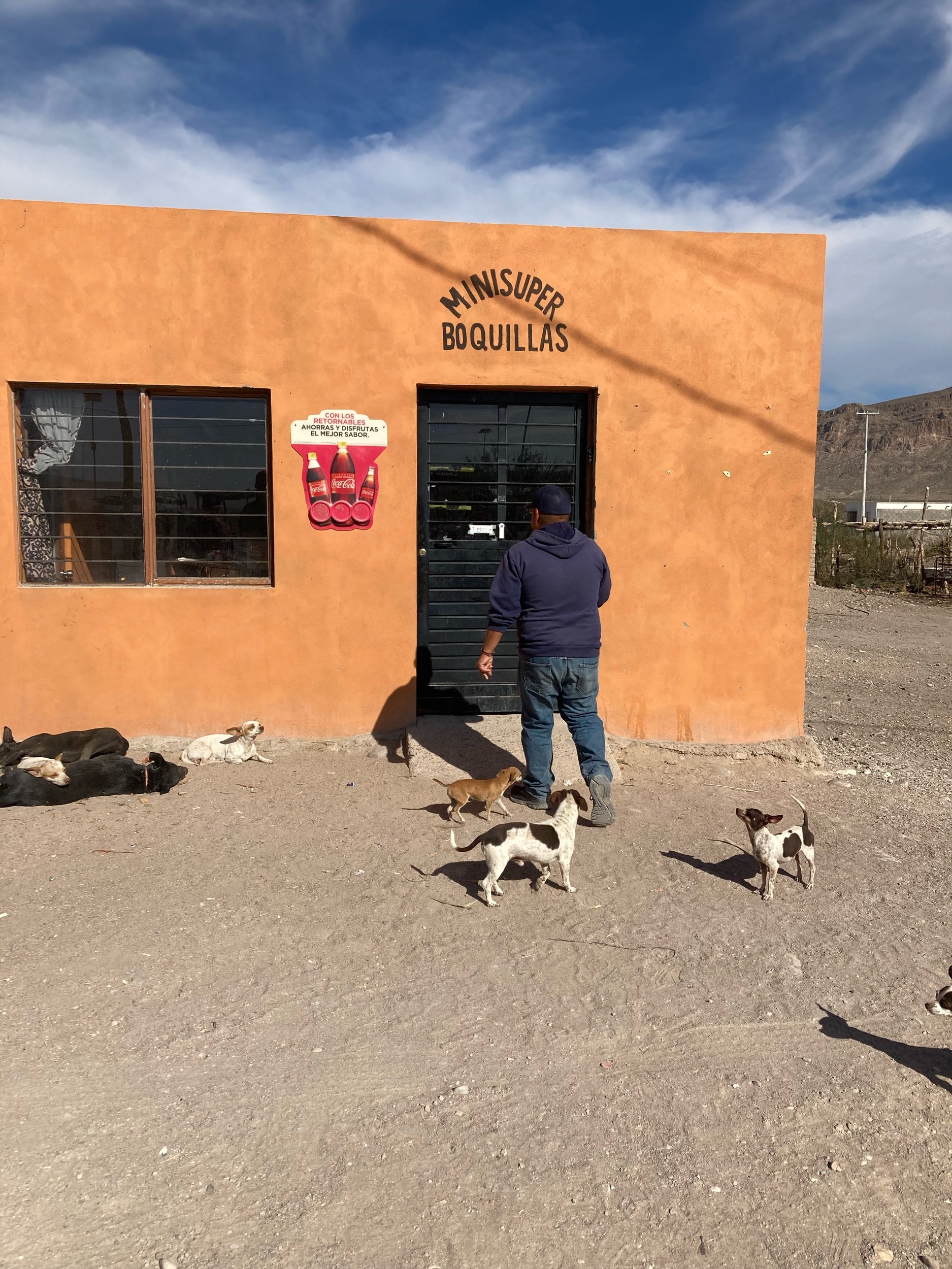
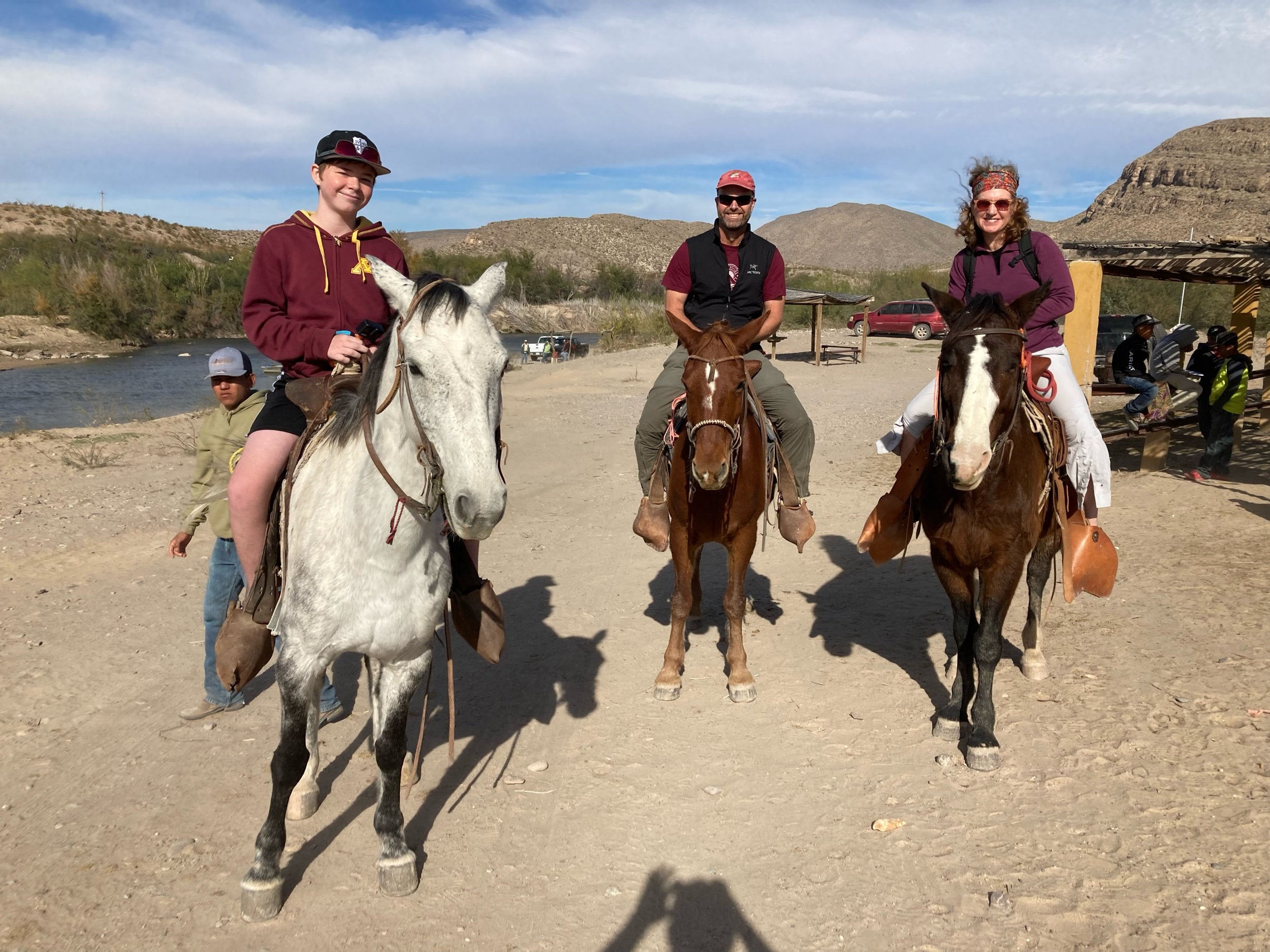
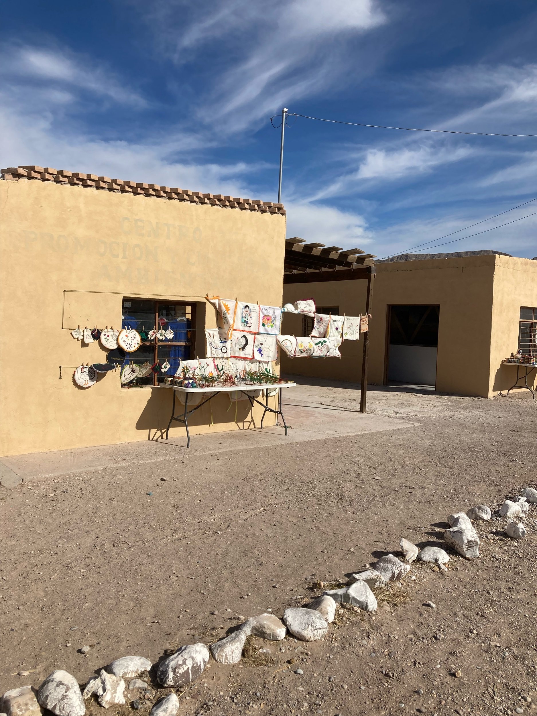
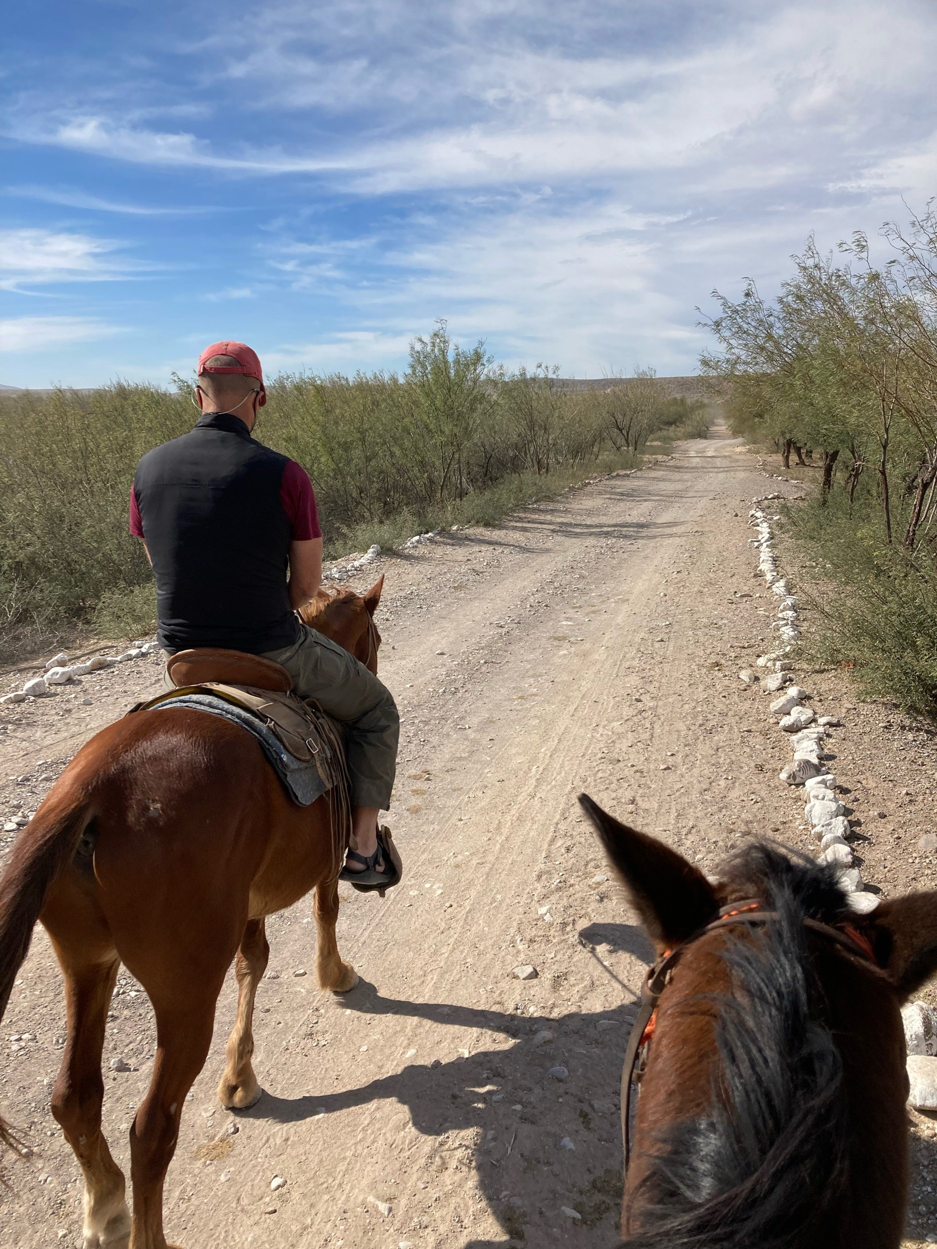
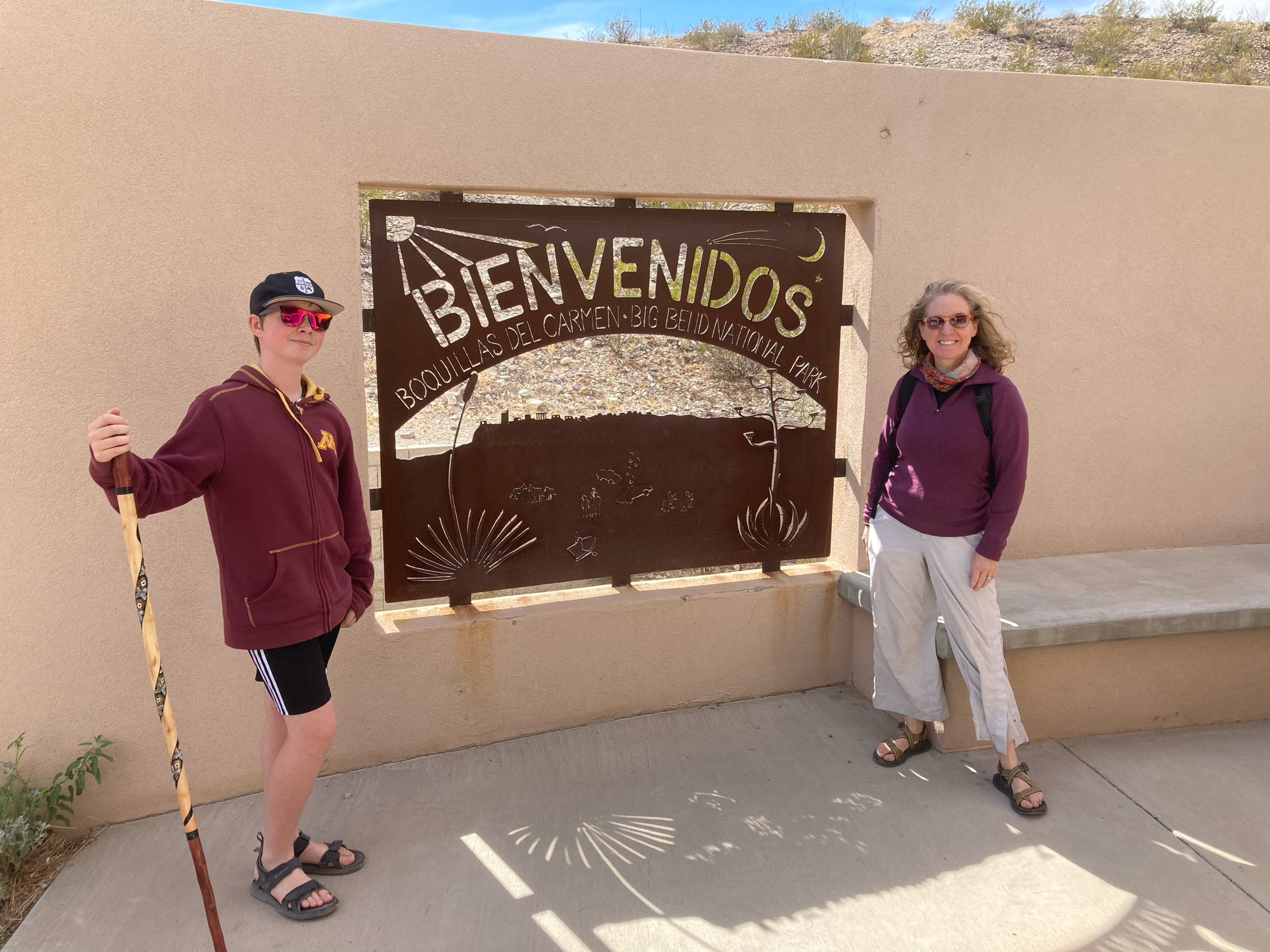
The next day was another long, full day. This was the day we decided to cross into Boquillas del Carmen. This is a border crossing from within the National Park. It is run as a joint effort between that National Park Service and the U.S. Border Patrol. We drove to this station, triple-checked to make sure we had our passports, and were sent off down a dirt trail to the river’s edge of the Rio Grande. There, we were the only Americans waiting to cross, and a rowboat from the other side made it to us in about 10 seconds (this was a small, short crossing). After paying about $5 each to cross (promised to be a round trip excursion), we hopped in and they took us over to the Mexican side. It’s worth nothing that Boquillas is 100% dependent on US tourism to survive. Given COVID, the border was shut for 20 months and it barely survived. There were lots of little kids running up to us selling woven bracelets, which of course, we purchased right away. We also had the option to walk into town, or take the horses. With a .75 mile walk in front of us down a very dusty road, we opted for the horses. The wind was howling and sand was EVERYWHERE. It wasn’t the most ideal experience, but Owen caught it on video for his YouTube channel and it is pretty fun to watch. Other than the town, this is a very desolate area. We were greeted by more children selling handiwork, and Owen bought a scorpion out of wire and beads.
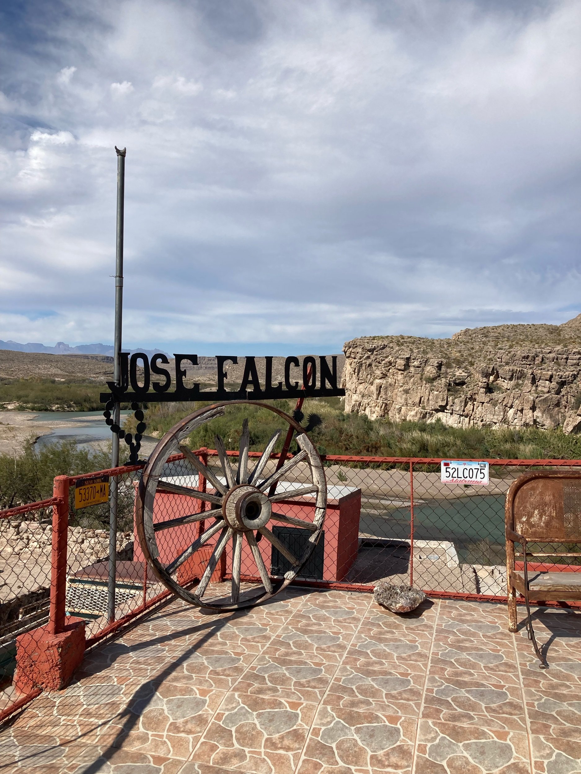
Seems that whoever leads you up into town on the horses also becomes your de-facto guide. Our guide for the day took us into the town, but really let us look around at our leisure. It was so windy that it was almost hard to enjoy the walk up and down the streets but we peeked into a small grocery store. Funny story - we needed some dry beans for one of Owen’s school projects and as Lajitas is SO remote, I was excited to find them in the store. But then I was reminded I couldn’t take them across the border since they were a food item! We had a great lunch at Jose Falcon - one of the two restaurants in town. Many of the local townspeople were also sending their arts and crafts, and as one of only a few tourists that day, I wanted to support their economy as best we could but as at all stops on this journey, we can only bring so much into the RV. Owen bought a really neat hand-crafted walking stick, and I found the cutest embroidered tortilla holder (wish I would’ve got more of those for gifts - next time).
After we had taken our share of photos and seen the town, it was time to head back. Forgot to mention that the road we traveled was also shared by very speedy trucks driven by the men of the town (another way to get back and forth). Our horses had to share the road with these drivers, and that made for an interesting (and very dusty) experience.
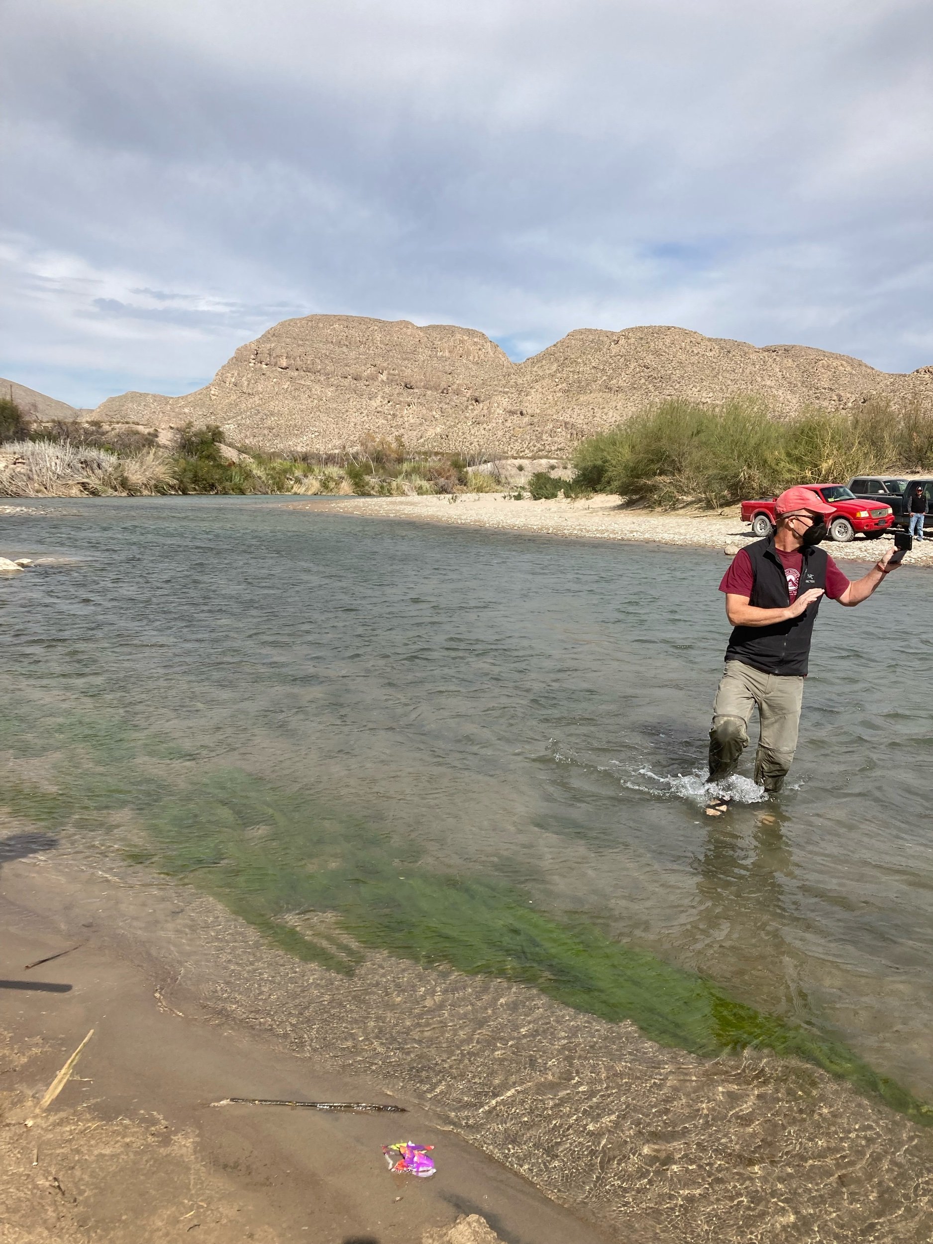
Owen and I hopped in the rowboat, but Tom really wanted to wade across the Rio Grande…..it was shallow enough so he could!
After we crossed back into the US (where we did have to go through customs), we headed over to the Boquillas Canyon hike. Beautiful hike, but we were sandblasted the entire way - so windy!!! We also made it over to the Hot Springs, where the water is about 105 degrees, and the hot springs pool sits right within the RIo Grande, looking over into Mexico. Neat experience overall.
There are three visitor centers within the park, and we discovered that the Panther Junction Visitor Center is the most informative yet all three are really good and the rangers are incredibly helpful.
After a long day, we finally headed back to Lajitas, stopping at the general store for a few necessary yet overpriced items - we’re pretty remote here so stocking up on food, necessities, etc is highly recommended. We did this, but we run out of eggs, milk ($7.99/gallon and not organic), and bread on a regular basis! Thankfully, this store has a pretty good selection and a wonderful deli counter as well, where we were able to get sandwich meat (we eat a LOT Of sandwiches on this trip….) especially for our day trips into the parks. RIght next to this store is the pen that holds the mayor of Lajitas…..a goat.
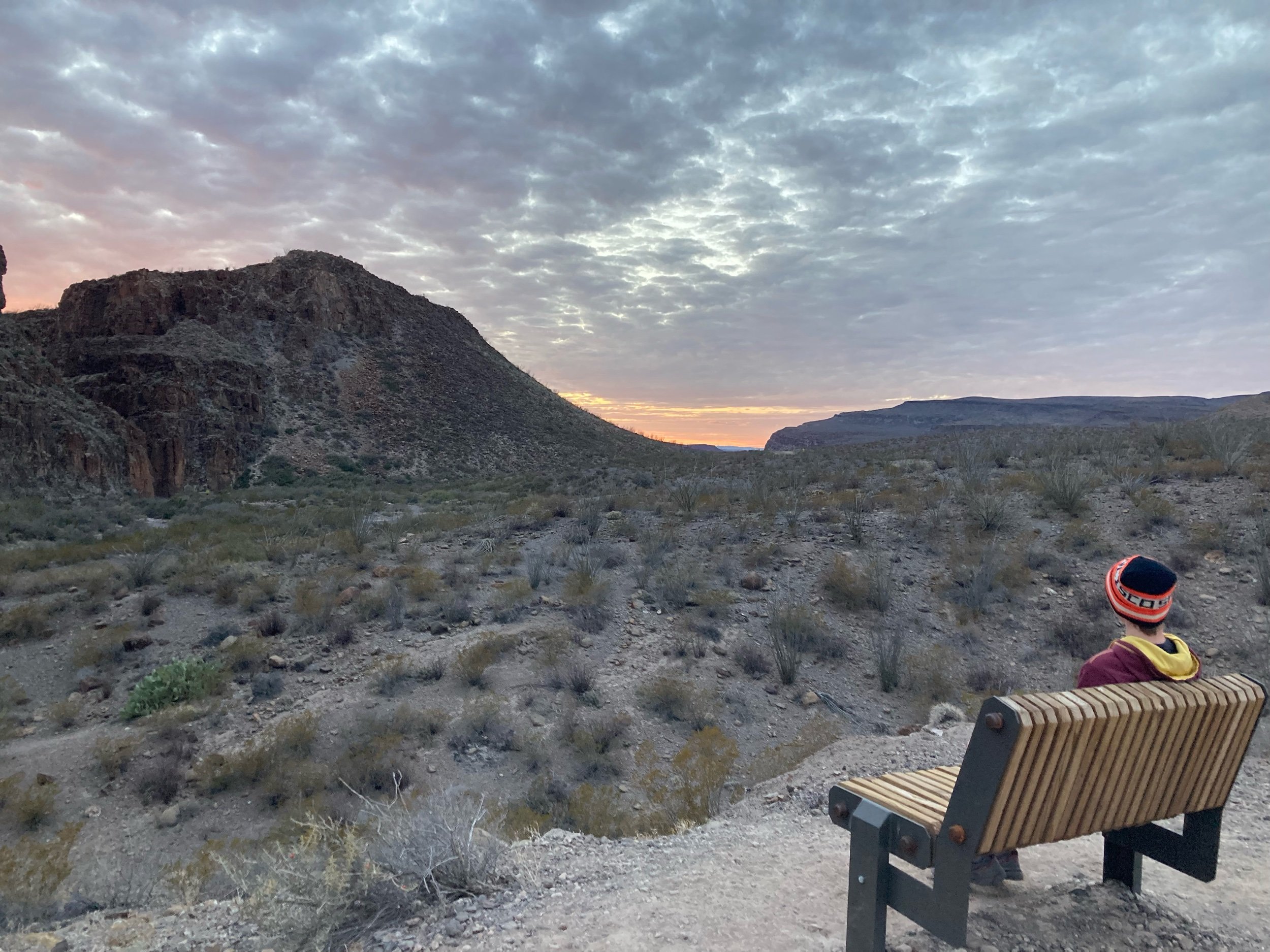
On our next day, we stayed closer to “home” and hiked to the picnic table about 1.5 miles up in the hills near our campground. Owen and I also explored the boardwalk in the Lajitas Village (which is essentially the Maverick Ranch hotel/shops area across the street from the campground). After that, we drove west for a bit - gorgeous views and this road also snakes through Big Bend State Park. We stopped at an area with 4 primitive campsites within the park as Tom wanted to also check out the boat landing here. There was one lone trailer there - a couple from Hoffman, MN actually - as well as their friendly cat, Boomer, which acted more like a dog. They suggested that we hike Closed Canyon trail within the state park, just a few miles down the road. There was still a few hours of sunlight left, so we did!
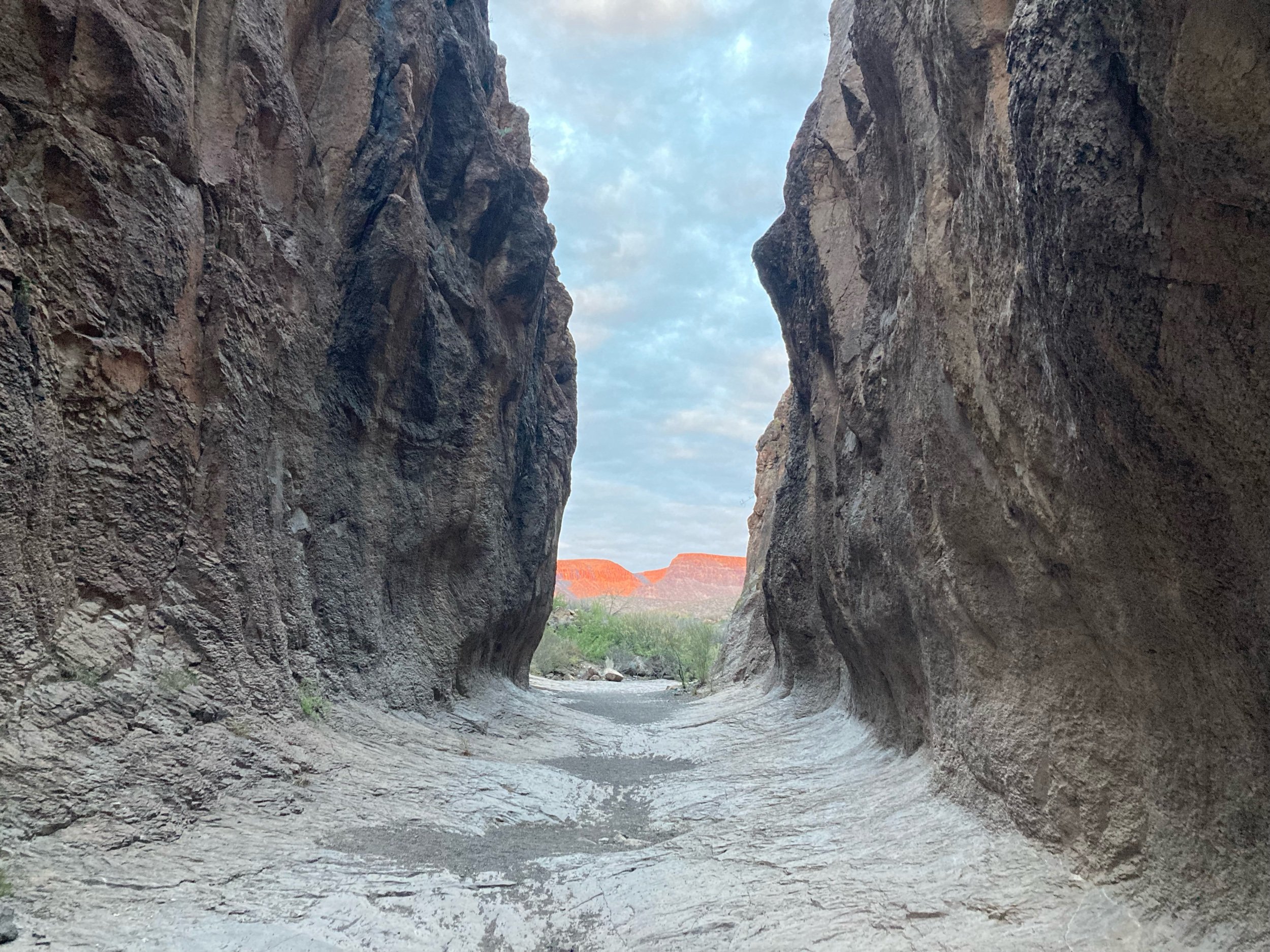
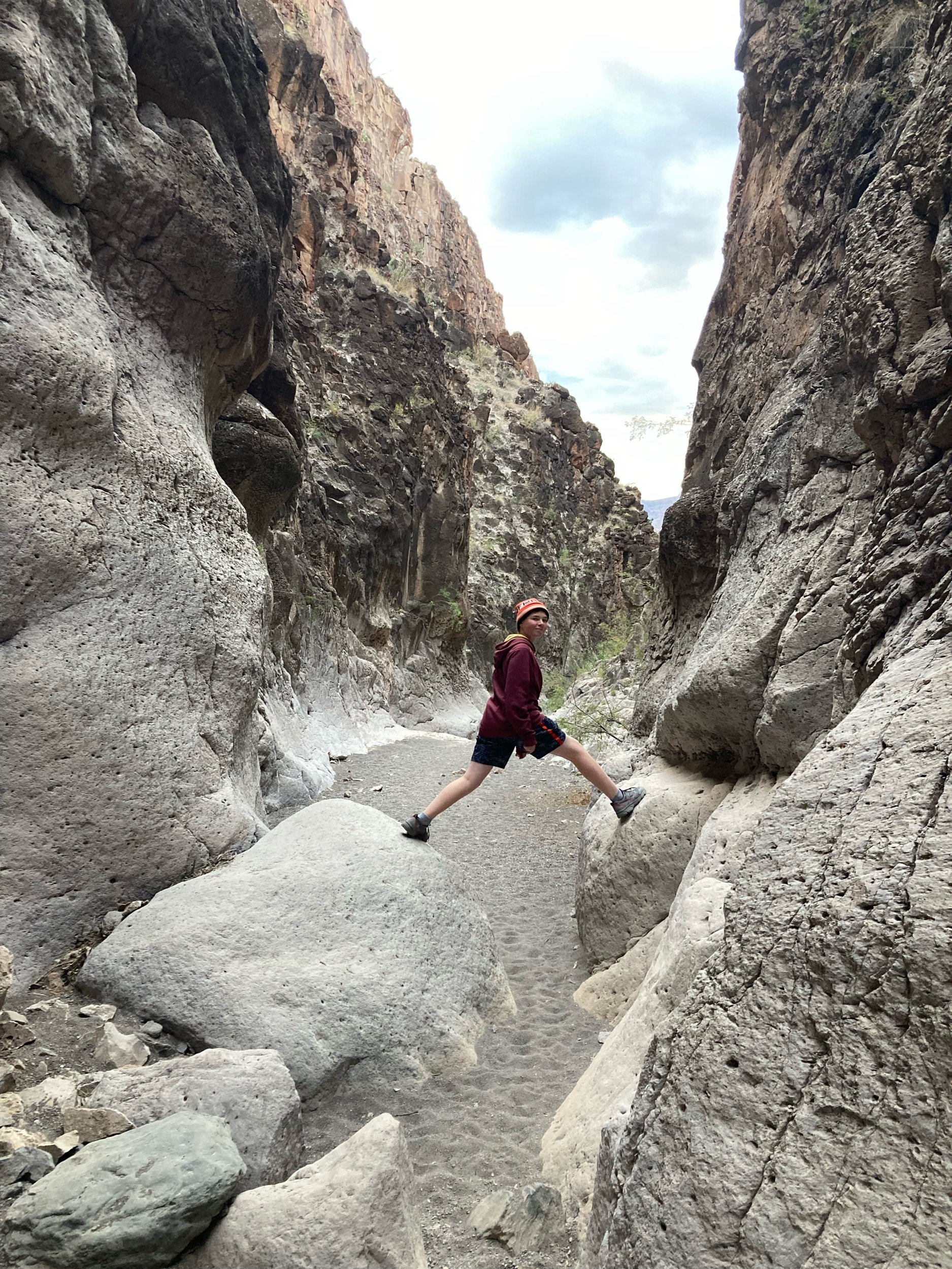
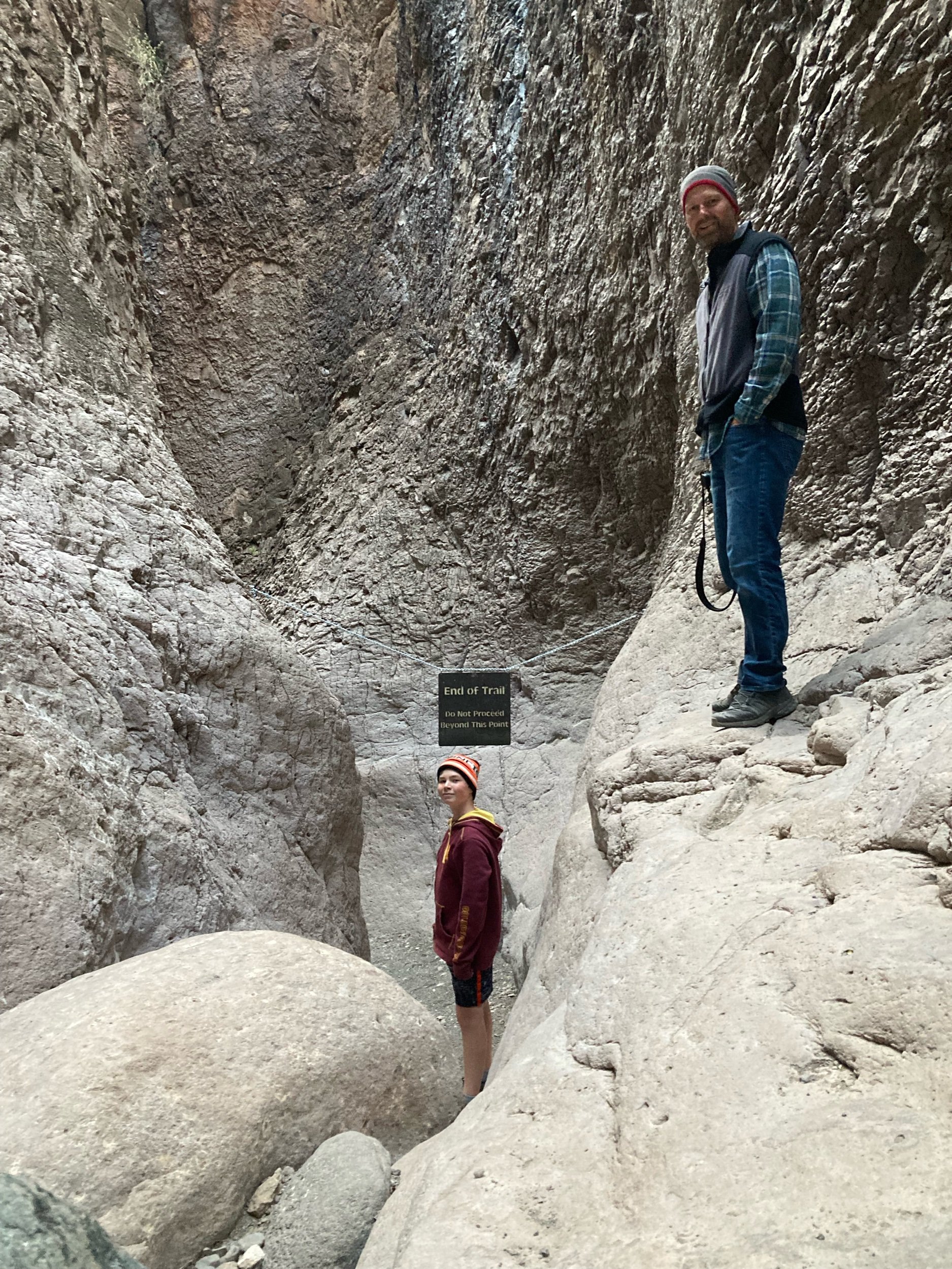
This was probably one of our most awesome hikes yet on this trip. The Closed Canyon Trail is a relatively short, 1.4 mile round trip hike through a narrow slot canyon. For those of you that want to get to it when you’re there, the trailhead is located approximately 22 miles west of the Barton Warnock Visitor Center and 26 miles east of Fort Leaton State Historic Site on River Road, FM 170. It was amazing! We loved it….and we were afforded the most spectacular view of the sun hitting the mountains when we emerged at sunset.


Another full day in Big Bend:
Dinosaur exhibit - there have been many fossils that have been found here
Drove up to Chisos Mountain and hiked the Chisos Basin loop (2 miles) and had lunch here while Tom grabbed a call
Drove off-road to Glenn Springs Road and hiked 3 miles on Pine Canyon trail. This trail led us through desert as well as what can best be described as the woods - it felt like we were hiking in Wisconsin, until we saw the random cactus here and there…
On our way out while we were on the dirt road, we came across a couple and their daughter from Ontario that were hung up on a massive rock in their Ford Class B van - there was another person that had stopped to help but between all of us, we couldn’t get them unstuck so we went for help. There isn’t any cell service in this area, and by this time, all of the visitor centers were closed. Thankfully, we were able to call the Chisos Mountain Lodge, and they put us in touch with the dispatch service. The crazier story here….we didn’t find out about their status until a few days later. I was checking by Facebook messages and there was a new message from a Fulltime Family, who had noticed that in one of the FTF groups, I had said our family was in Big Bend for the week. She was reaching out as another FTF to see if it would be at all possible for our paths to cross while we were both there. As I was reading her message and looking at her picture, I quickly realized that THIS was the family we stopped to help!! I felt bad for not seeing her message earlier (she had actually reached out before this incident took place but I hadn’t seen it). Thankfully, we learned that the ranger HAD come and rescued them, and found them a place to camp for the nite in one of the campgrounds.
We stopped for burgers on the way back at the High Sierra Bar and Grill in Terlingua- the large, oversized cold Mexican cokes were the BEST after a long day.
The following day, Owen and I did a video tour of the RV, which was kind of fun (he did a great job editing!). He’s been creating videos along the way, which will be so cool to have for posterity. But mostly excited because we just booked ONE MONTH in Jackson Hole, May 8 through Jun 4. Will be here before we know it.
On our final day in the area, we got on our bikes and explored Big Bend State Park near our campground. Or at least tried. On mile 1, I totally bit it and slammed down on the ground, resulting in lots of cuts and bruises and a very sore elbow and thigh! Tom and Owen cotniued and I limped back to the campsite…
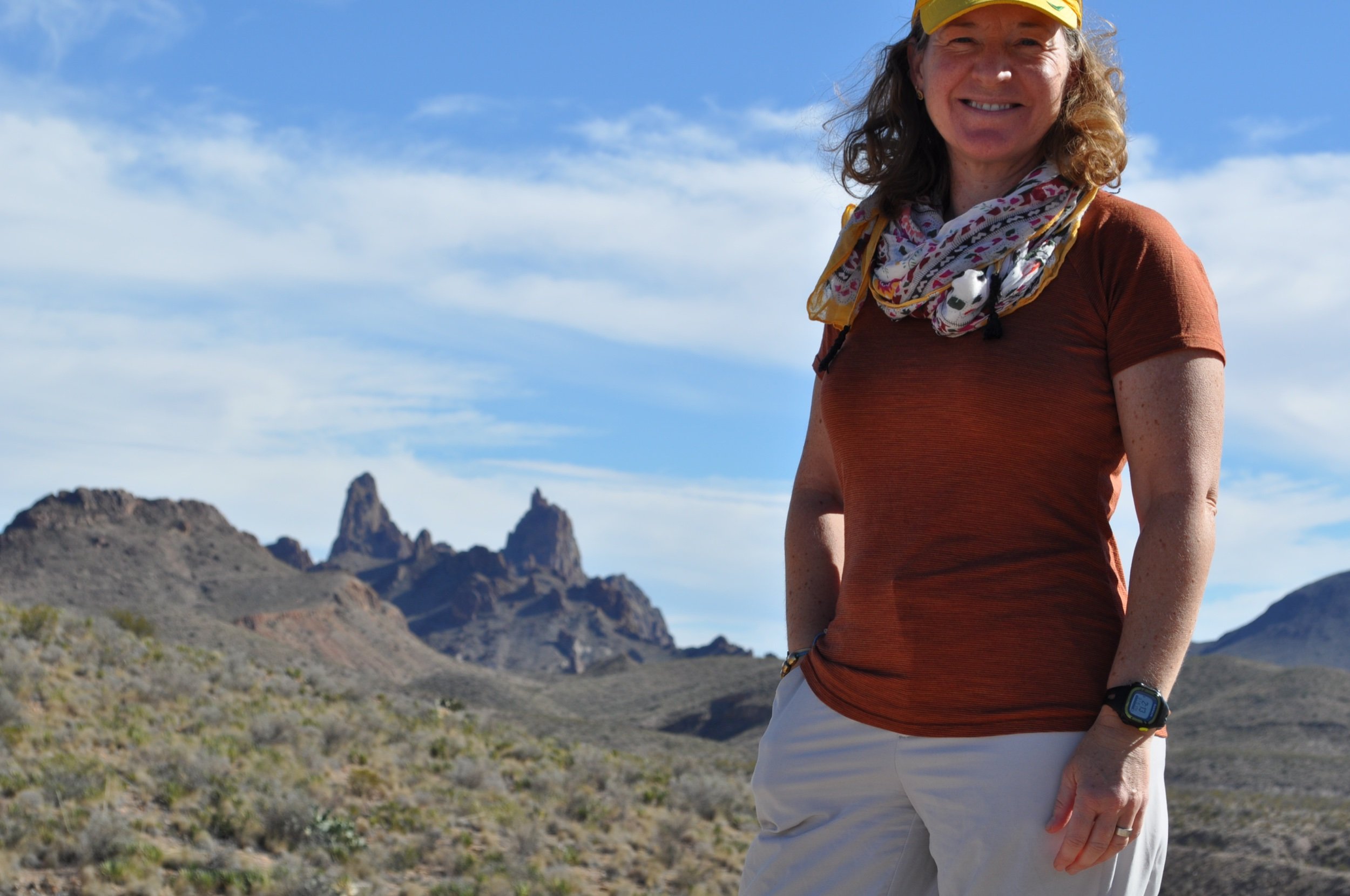
Tom and I drove to a scenic overlook in the park, stopped at an old movie set where westerns had been filmed, and on our way back, saw well over 50 long-horned sheep crossing the road into the canyons and hills. Our pizza place here is Gizzi Up, which had good pizza, yummy pastries and a great patio to enjoy it all.